Bass Strait was not always a strait. It used to be a plain populated by Indigenous peoples who moved back and forth between what we now call Victoria and Tasmania.
Scientific evidence shows that the first humans arrived on land now known as Tasmania/Lutruwita around 40,000 years ago when sea level fluctuations provided access across a narrow land bridge. About 30,000 years ago an ice age began, which caused sea levels to drop about 120 metres and created a continuous land mass that stretched between present day Papua New Guinea and Tasmania.
When the ice melted – a process estimated to have taken 6,000 years – a strait formed and became an almost impassable barrier by about 12,000 years ago.
Iain Davidson and David Roberts, ‘14 000 BP – On Being Alone: The Isolation of Tasmania’:
They were alone for five hundred generations, knowing no other people in the world, living with the knowledge and beliefs derived from those they had known before the sea surrounded them.
Tasmania’s First Nations people
Tasmania was, and continues to be, known as Lutrawita by First Nations peoples from the region. Lutrawita (Tasmania) was home to many different First Nations language groups.
The clashes between the original inhabitants and white settlers were amongst the worst in the country, leading to the infamous Black Line in 1830, which was an attempt to drive First Nations people from their lands and corral them on the Tasman Peninsula.
While the Black Line was a failure, it unsettled the First Nations population enough that they agreed to be resettled on Flinders Island in Bass Strait. This in turn led to the widespread, but erroneous, belief by the 1870s that Tasmania’s First Nations people had died out.
Settler Tasmanians refused to acknowledge that First Nations identity and culture endured through the children of First Nations women and white men. These were largely descendants of women who married or lived with sealers and who lived primarily on the islands of the Furneaux group in Bass Strait.
This lack of recognition had an impact in the latter half of the 20th century when First Nations people who ‘looked white’ began political agitation for recognition of their Indigeneity and land rights.
European exploration and settlement
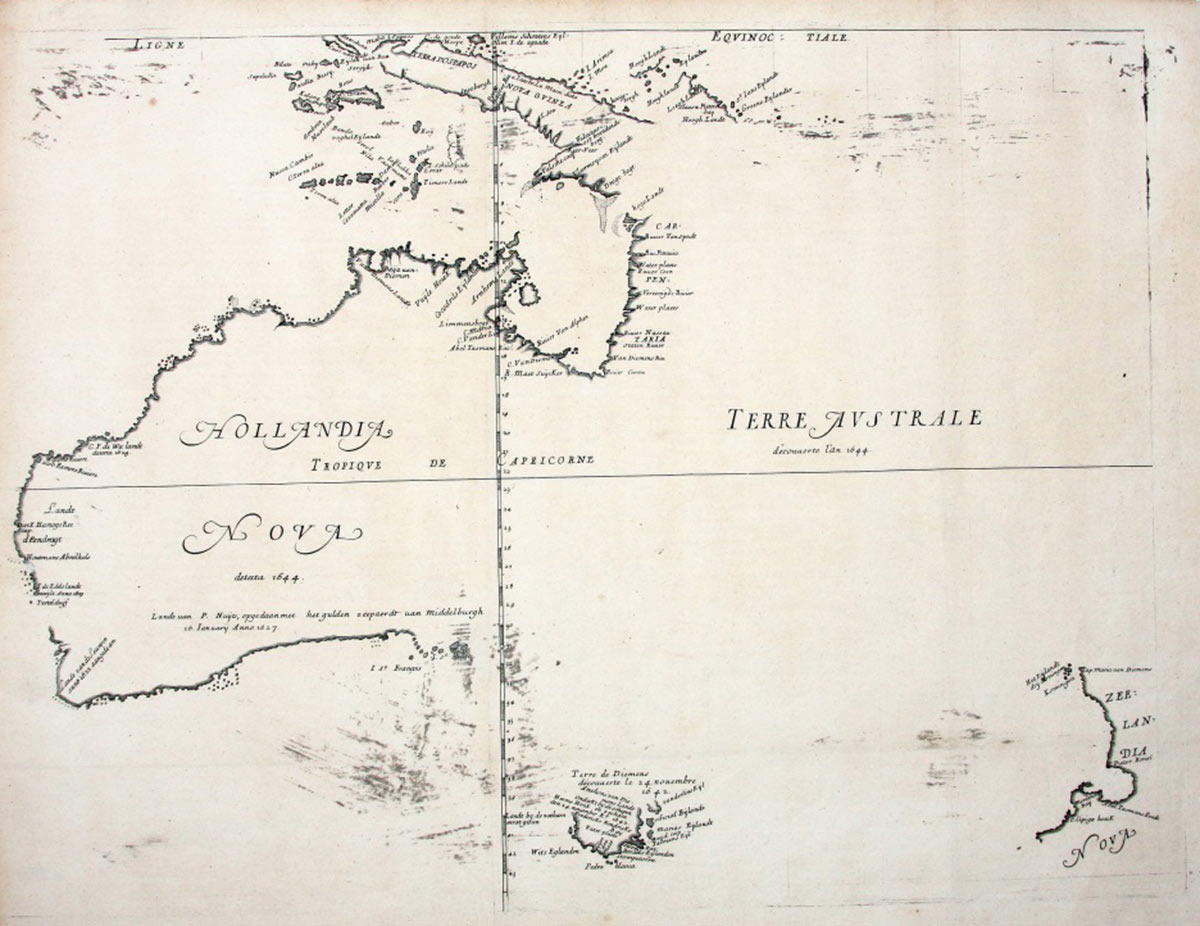
Prior to Matthew Flinders coining the name ‘Australia’, the larger landmass created by the retreat of the ice had been called different names by other European explorers.
Since antiquity, persistent rumours existed of an unknown southern continent called Terra Australis Incognita.
During the 1600s European explorers gave versions of this name to islands discovered in the Pacific.
The Dutch, whose ships frequently came to grief on the west coast while sailing to Batavia (now Jakarta), called the continent New Holland. Abel Tasman, who mapped and claimed parts of present day Tasmania in the 1640s, named the island Van Diemen’s Land to honour the Governor of the Dutch East Indies.
In 1770 Lieutenant Hicks was the first on board HMB Endeavour to sight the continent’s east coast. Captain Cook named Point Hicks in present-day Victoria after him and turned north, before reaching the island.
In mapping the east coast of the mainland, Cook helped establish Britain’s claim to the eastern half of the continent, and he identified Botany Bay as the site for a colony.
George Bass left Sydney in an open boat in December 1797 to explore the southeast coast of Australia and reached Western Port in Victoria. On his return to Sydney, he reported his conviction that a strait existed that separated Van Diemen's Land from the mainland, and he was instructed to return for conclusive proof.
Bass and Flinders sailed from Sydney on the Norfolk on 7 October 1798 and returned three months later having successfully circumnavigated the island. Following Flinder's suggestion, the strait was named after Bass.
While Bass returned to England, Flinders continued his exploratory work and became the first European to circumnavigate the mainland, with the assistance of Bungaree, a First Nations man from Garigal country around Broken Bay north of Sydney. In his published journals, Flinders put forward the case for naming the continent Australia.
Once it was known to be a separate island, the British saw Van Diemen’s Land as being vulnerable to the territorial claims of other nations.
In 1803 the Governor of New South Wales, Philip Gidley King, anxious to pre-empt the French, sent 49 people under the command of Lieutenant John Bowen to establish a settlement in the Derwent estuary.
The following year, David Collins, who had been appointed Lieutenant Governor of Van Diemen’s Land, reached the Derwent from England with 430 people. His settlement became Hobart.
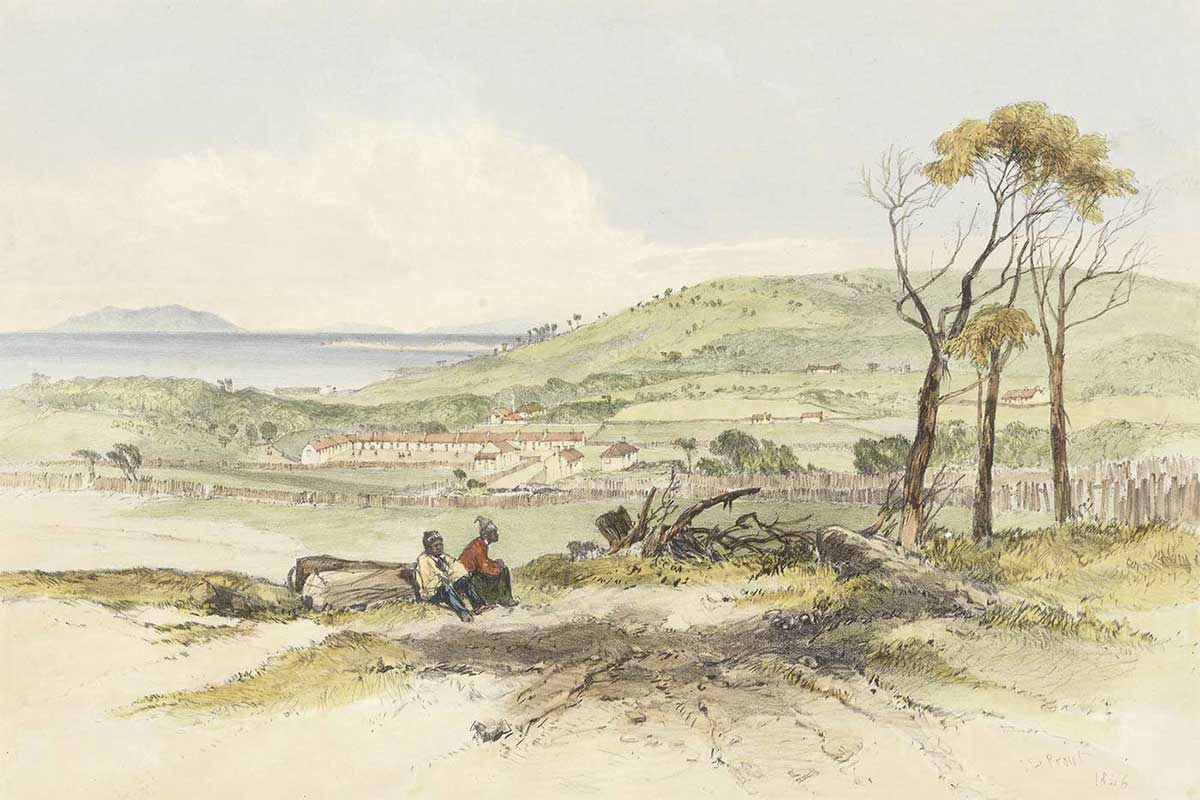
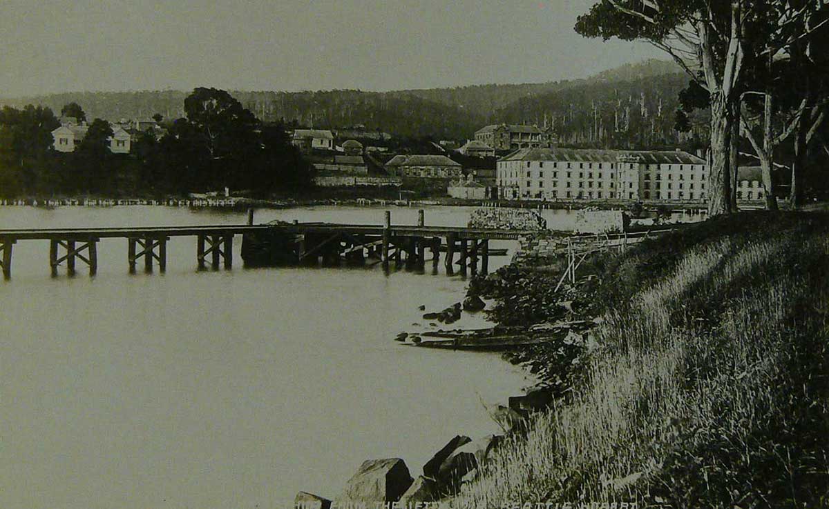
Small and remote, Van Diemen’s Land would soon become a secondary punishment site for convicts who had reoffended after their arrival in New South Wales or were not amenable to control. The geography of the selected site on the Tasman Peninsula, named Port Arthur, was exceptionally well suited to its role.
Tasmania and the mainland
The history of Van Diemen’s Land as a convict island dogged its reputation, and in 1856, three years after transportation ceased, the island’s name was formally changed to Tasmania.
Some settlers were attracted to the island’s cool climate, plentiful rainfall and fertile soils that offered a closer approximation to the homes they had left in the British Isles.
Although rich in natural resources, Tasmania’s size, geographic isolation and small population placed limits on its economy.
During discussions in the lead up to Federation, Tasmania was concerned that the larger mainland states would have more power. So it negotiated a deal that allowed states to retain three quarters of the income generated from tariffs on imports – a significant source of income for the island.
Being an island, Tasmania is sometimes overlooked by mainlanders. The most notorious official instance of this forgetfulness was in 1982 when Tasmania was left off the map at the Commonwealth Games opening ceremony in Brisbane.
At the 2014 Commonwealth Games in Glasgow, the swimming team’s costume also featured a map in its design, and again, the island state was not shown.
Yet, in recent decades Tasmania has become a popular tourist destination that draws large numbers of mainlanders (among others) who are attracted by the island’s natural environment, convict heritage sites and vibrant arts scene.
In our collection
You may also like
References
Patsy Cameron, Aboriginal life pre-invasion, The Companion to Tasmanian History
Ros Haynes, Van Diemen’s Land, The Companion to Tasmanian History
Iain Davidson and David Roberts, ‘14 000 BP – On Being Alone: the Isolation of Tasmania’, in Turning Points in Australian History, Martin Crotty and David Roberts (eds), University of New South Wales Press, Sydney, 2009.